TN InSight008 Creating Data Maps using GeoCoordinates in InSight
![]()
Description
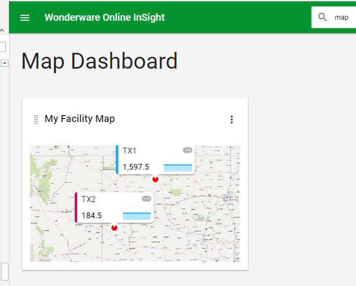
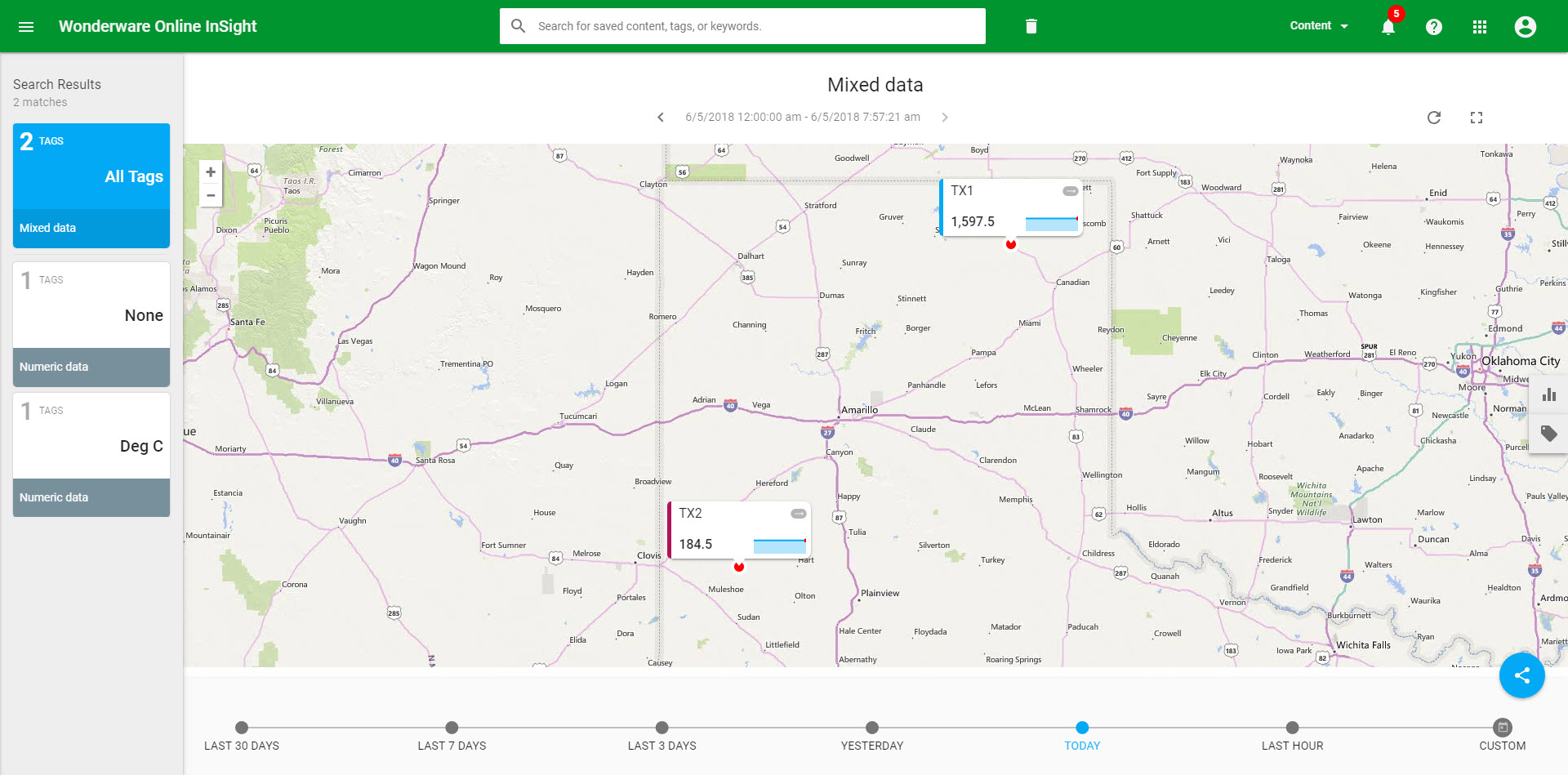
This article from InSource shows how to display current value data for Historian tags in the Wonderware cloud, aka, InSight. This might be used to provide overview information for geographically dispersed operating facilities.
- Author: Chris Selph
- Published: 6/5/2018
- Applies to: Wonderware OnLine Historian InSight
Workflow
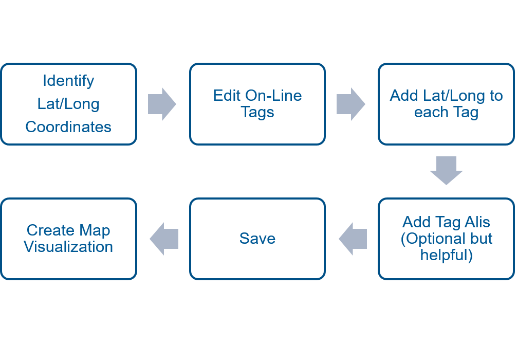
Steps
Identify the latitude and longitude coordinates for each plant site.
You can use Google maps for this, just right click and click "What's Here" and a card will appear at the bottom with the lat/long.
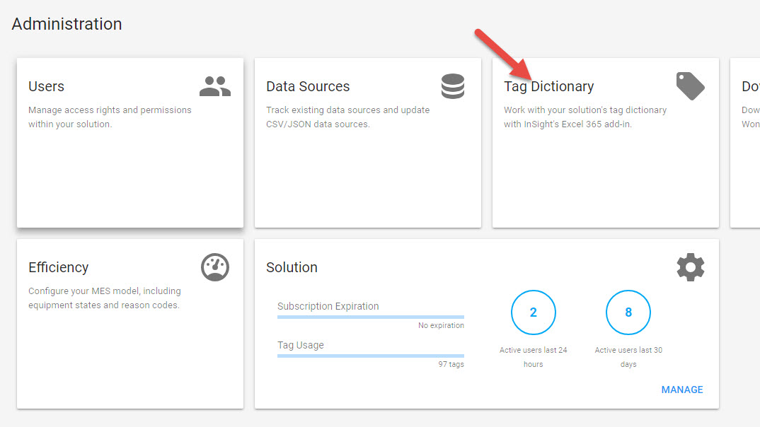
Edit Your Tags to associate lat/long
Using the Admin portal, edit your Tag Dictionary. Note this requires MS Office 365 / online Excel.
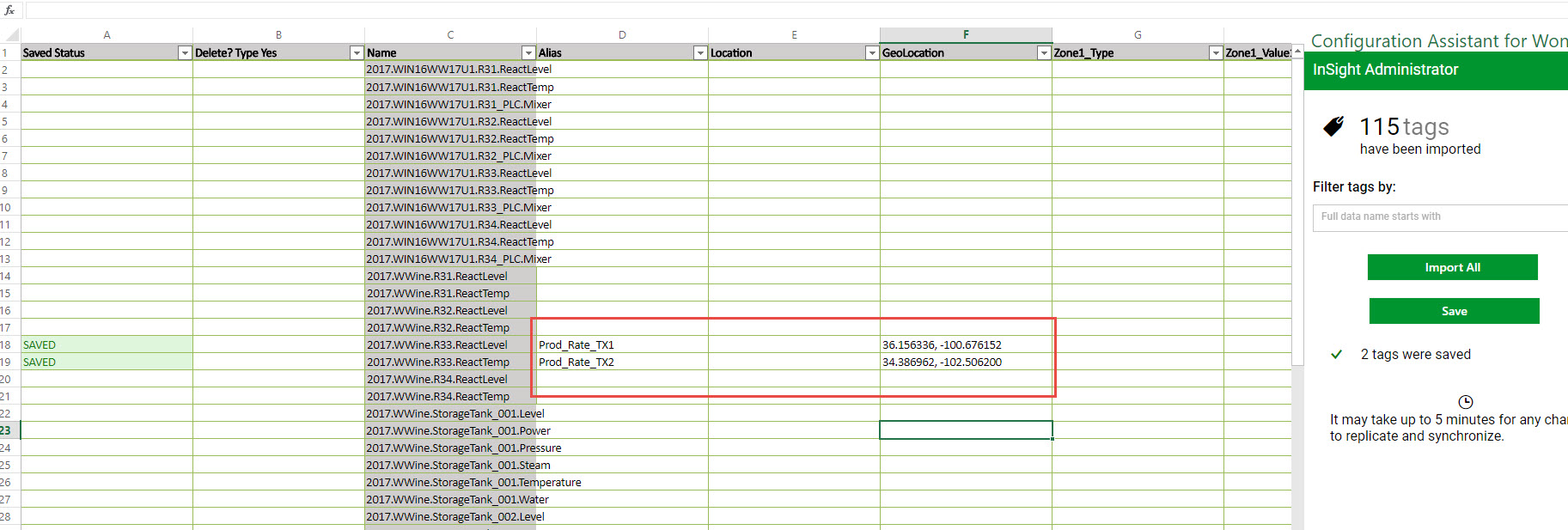
Add Lat/Long coordinates in the GeoLocation field, alias if you prefer and Save.
Create Map Visualization
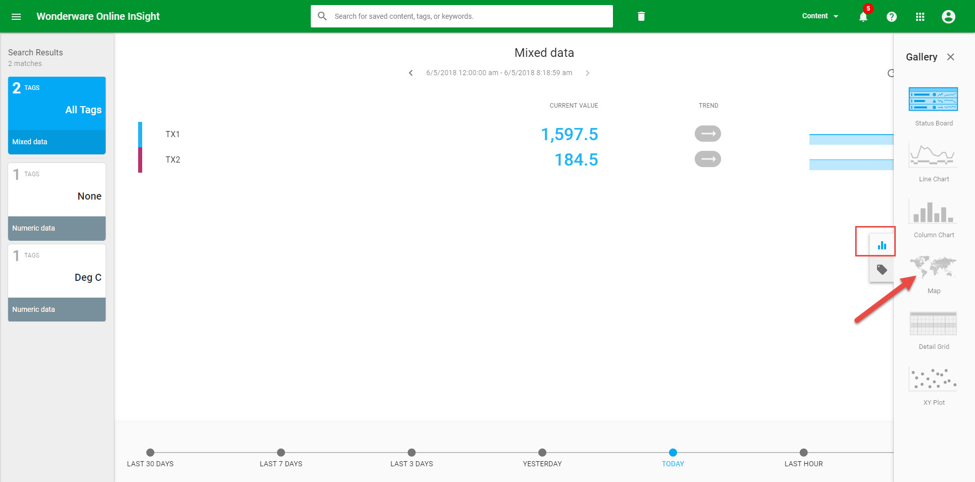
Add your Tags to a clean visualization via search
Choose a map visualization from the Gallery
Save your map and even create a dashboard of maps!